Difference between revisions of "Kincardine Township"
From Genwiki
| Line 1: | Line 1: | ||
CHAPTER XXXII | CHAPTER XXXII | ||
| − | ==TOWNSHIP OF | + | ==TOWNSHIP OF KINCARDINE== |
===EXTRACT FROM THE REPORT OF COUNTY VALUATORS, 1901.=== | ===EXTRACT FROM THE REPORT OF COUNTY VALUATORS, 1901.=== | ||
Revision as of 16:48, 24 June 2006
CHAPTER XXXII
TOWNSHIP OF KINCARDINE
EXTRACT FROM THE REPORT OF COUNTY VALUATORS, 1901.
“This township has a very considerable portion of rough land, broken by creeks that are very injurious, rendering agricultural pursuits difficult, many farms with scarcely a level field upon them. These remarks apply to that portion of the township south of the 6th concession. There is considerable light and sandy land in this township. Two strips cross from north to south and average from one and a half to two miles in width. There is also considerable light and stony land on the Lake Range. In buildings this township has not kept pace with adjoining municipalities, excepting the northern portion, which will compare very favorably with other parts of the county. The rate per acre for Kincardine township is $32.45. The rate per acre of village property in this township is about 34 cents”.
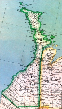
THE survey of Kincardine Township was not made, like that of most of the townships in the county, as a whole and at one time, but in three sections and in different years. As related in Chapter II., in 1847 Alex. Wilkinson, .P.L.S., surveyed the Lake Range lots, and in 1848-49 A. P. Brough, P.L.S., laid out the Durham Road and three concessions to the north and south of it. Then followed, in 1850, the survey of the remaining portion of the township, which included concessions four to twelve. This last survey was made, by J. W. Bridgland, P.L.S., under circumstances mentioned in Chapter V. The lands in Kincardine were among those set apart as school lands, the price of which at first was fixed by the Crown at 12s. 6d., but subsequently reduced to 10s. In Appendix H is given a copy of the advertisement offering the lands in the township for sale,2 which were among the first in the county offered for sale.
PIONEERS
For the first ten years of its history Kincardine was the leading township in the county of Bruce. This was brought about by the comparative readiness of access thereto by water, giving it not only the earliest of the pioneer settlers, but also the largest number of them. That it was the senior township in the pioneer days is borne out by the corporate name by which the municipality of the county was then known, namely. “The United Townships of Kincardine and the remaining townships within the county of Bruce.” Leading, therefore, as Kincardine did, in settlement and also in municipal matters, the author has, in the writing of this History, been led to record, in Chapters III., IV. and V., relating to the history of the county at large, many early events especia1ly associated with Kincardine, and the reader of these pages of the township’s history is asked to recall what is written relating to it in the above-mentioned chapters; and as until January 1st, 1858, the village of Penetangore was unincorporated and formed part of the township of Kincardine, the history of the village at first was that of the township, so that the chapter following this, on the town of Kincardine, must also be consulted to obtain a complete historical narrative of the township.
The first settlers to enter the township, as well as the first in the county, were Allan Cameron and Wm. Withers, who in the spring of 1848 settled at the mouth of the Penetangore River, months before the town-plot of Kincardine was surveyed. During the following summer and fall, Donald, Alexander and John McCaskill, James and Alexander Munroe and some others settled on the Lake Range and on the North Line. At the same time the Durham Line received its first settlers in the persons of John C. Digman and Major William Daniel.
There was a steady inflow of settlers into Kincardine in 1849, who squatted on lands not yet offered for sale. Along the lake shore farm lots were taken up by George and Alex. Ross, George and Alex. Murray, James, Duncan, Robert and John Rowan, Malcolm, John and Murdoch McLeod and Archibald Sinclair. About this time also the “free grant” lots received many settlers -- so many, in fact, that only a few names can be here mentioned, such as George Ryckman, Samuel Taylor, William Fanning, Robert Stewart, John Sellery, William Millar, Robert Brown, Thomas Harris, John Hays, Nicol McIntyre, William (Dalhousie) Miller and W. L. Armstrong, all residing on the south side of the Durham Road. On the north side there was Jacob Latschaw, John Mosely, William G. Cuyler, John
1 “Kincardine” is one of the titles of the Governor-General of Canada in office at the time the survey of the “Queen’s Bush” was made, viz., the Earl of Elgin and Kincardine.
In the outline map of the proposed townships in the “Queen’s Bush” referred to in Chapter II. the name first written as that of this township was “Lambert,” while the name “Kincardine” appears on that now known as “Wallace,” in the county of Perth. These two names there show as being crossed out and the present names written in with lead-pencil.
2 The entries in the books of the Crown Land Department show that the first sale was made on August 19th, 1951, to Sam Splan, of lot 26, concession 3, S.D.R.
Select Kincardine for details about the town.
